In a new study, researchers at Purdue University have harnessed the power of advanced computer modeling to unravel the complex reasons why the United States has more tornado activity than any other region in the world.
The study, spearheaded by Dr. Dan Chavas, an associate professor in the Department of Earth, Atmospheric, and Planetary Sciences, delves into the geographical and climatic factors that make America the country with the strongest, most violent, and numerous tornadoes worldwide.
“We have had these decades-old assumptions about what causes storms,” Dr. Chavas said in a press release by Purdue University. “We’re [now] validating those hypotheses and figuring out what makes North America such a hot spot.”
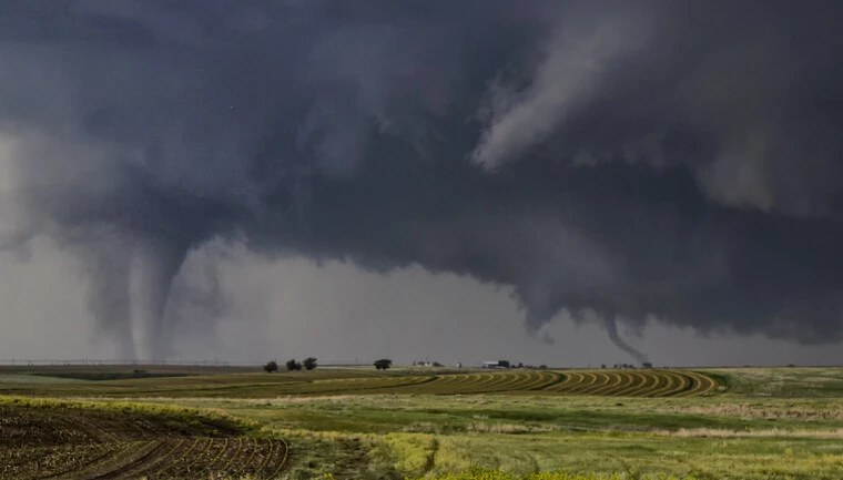
The United States averages over 1,200 tornadoes every year, a staggering figure that surpasses the total annual twisters of all European countries combined. The country that ranks second, Canada, only averages 100 tornadoes per year.
This prevalence of tornadoes in America has long been assumed to be due to its unique geography, which provides ideal conditions for tornadoes to form.
“No place else in the world has the large warm water on its equatorward side with a wide high range of mountains extending from north to south to the west of it,” said Dr. Harold Brooks, senior scientist with the NOAA National Severe Storms Laboratory. “All the other tornado-prone regions have at least one feature suboptimal.”
In research published just published in the Proceedings of the National Academy of Sciences, Dr. Chavas and a team of Purdue researchers turned to detailed historical storm data and sophisticated computer models to imagine and test what-if scenarios and scientifically answer the question of why the U.S. is the world’s “Tornado Alley.”
“We use weather and climate models, as well as extensive databases of thunderstorms, lightning strikes, atmospheric data, and more, to ask, ‘What if the world was different?‘” Dr. Chavas explained. “We can use these models as laboratories to ask questions like ‘What happens to the weather if you flatten the Rocky Mountains? What about if you fill in the Gulf of Mexico? What aspects of the modern continental and mountain configurations really matter? Let’s actually test this prevailing, conventional wisdom.“
For decades, meteorologists have hypothesized that the Gulf of Mexico plays a crucial role in forming tornadoes in the United States. The warm, moist air from the Gulf is thought to collide with cooler, drier air crossing over the Rocky Mountains in the west Rockies to create the perfect conditions for severe weather.
Dr. Chavas’ team tested this theory using computer models to simulate what would happen if the Gulf of Mexico were replaced with land.
Surprisingly, they found that while the absence of the Gulf shifted the location of severe storms eastward, from the central Great Plains into Illinois, it did not significantly reduce their frequency or intensity.
Working with Purdue graduate student Funing Li, Dr. Chavas then used computer modeling to compare severe weather potential in North America and South America. Though South America is geographically similar and has as many severe thunderstorms as the U.S., the region experiences far fewer tornadoes than North America.
Results showed that the roughness of the land surface east of the Andes mountains, particularly the dense forests of the Amazon, significantly inhibits tornado formation in South America. In contrast, the smoother surface of the Gulf of Mexico allows for greater wind shear, a critical component for tornado development.
The team also conducted climate model experiments in which equatorial South America was smoothed similar to an ocean surface. This resulted in a drastic increase in South America’s tornado potential.
In subsequent modeling, researchers roughed the Gulf of Mexico to resemble the Amazon’s land surface. These simulations revealed that central North American tornado potential substantially decreased.
“A rough surface upstream means that downstream the wind is no longer changing speed and direction with height very strongly near the surface, which we refer to as ‘wind shear,‘” Dr. Chavas said. “It doesn’t change ingredients for severe thunderstorms, but the wind shear in the 1 kilometer of air above the ground is a critical ingredient for tornadoes.“

The findings suggest that conventional wisdom on what makes America such a hotspot for tornadoes has overlooked the significant role that a smooth, flat ocean-like upstream surface plays in tornado frequency.
Dr. Chavas says his recent work extends beyond understanding current weather patterns. It has significant implications for predicting future weather in the context of climate change.
“If we want to understand how climate change will affect weather in the future, we need to understand how climate determines weather in the first place,“ Chavas explained. “We don’t have a very good understanding of how climate controls the severe weather we have.“
As global temperatures rise and atmospheric patterns shift, understanding the dynamics of tornado formation is crucial for forecasting future trends. By leveraging advanced computer models and challenging long-held assumptions, future research can help inform policies and practices that could mitigate the impact of severe weather on communities across the globe.
Understanding the broader impact of surface roughness on weather patterns could also lead to discovering ways to alter dangerous weather conditions. For example, reforestation efforts in the eastern United States could potentially alter tornado activity, similar to how the Amazon affects South America’s weather.
“If we change the land surface and the trajectory of air flowing inland from the Gulf of Mexico, it may have a direct impact on these ingredients that give rise to tornadoes farther inland,“ Dr. Chavas explains. “When we think about climate change, we think about it getting hotter and the land getting drier. But if the jet stream changes where and how quickly air flows inland, it can change where and how tornadoes form. Places that didn’t see them before may see them more, and places that had more may see fewer.“
“We need to understand the weather now to help us better predict the weather of the future.”
Tim McMillan is a retired law enforcement executive, investigative reporter and co-founder of The Debrief. His writing typically focuses on defense, national security, the Intelligence Community and topics related to psychology. You can follow Tim on Twitter: @LtTimMcMillan. Tim can be reached by email: tim@thedebrief.org or through encrypted email: LtTimMcMillan@protonmail.com