Frozen and barren, the Arctic landscape may seem uninteresting, but for NASA Jet Propulsion Laboratory (JPL) scientists, this environment offers a unique chance to study the effects of global warming. To do this, the team is developing a series of autonomous robots that are 8 feet long and equipped with specialized sensors to measure how warm ocean water interacts with ice. The project, called IceNode, could explore the unknown and dangerous freezing waters of the Arctic ice sheets.
The High Arctic: A Treacherous Area
The North Pole and nearby areas have been an area of interest for many decades, from developing a route to the Soviet Union during World War II to patrolling the area with submarines to establish clear territories.
Before the 1930s, traversing this treacherous terrain was tricky, as submarines weren’t advanced enough yet to navigate the polar ice caps. Explorers like Ernest Shackleton, who made a name for himself exploring Antarctica, were one of many who met a common fate when exploring both the north and south poles: ships couldn’t detect ice floes in the water until it was too late, and they crashed.
It wasn’t until 1958 that the U.S. submarine, the Nautlius, made the first-ever to the North Pole. The nuclear sub started in Point Barrow, Alaska, and then traveled nearly 1,000 miles to reach the top of the North Pole before pivoting and landing in Iceland. The trip was part of a top-secret mission codenamed “Operation Sunshine,” and it showed the first proof that submarines could operate fully submerged.
Part of the Nautilus‘s success was the invention of sonar. Sonar (from sound navigation ranging) was first proposed in the mid-1910s as a way for submarines to detect icebergs. Using a projector that could bounce sound waves off objects, an individual could “see” what objects were ahead of them depending on how the sound waves were reflected. A rudimentary system was built in 1918 by U.S. and U.K. scientists.
While sonar devices have vastly improved since their initial development, navigating submarines today still presents challenges. Thick layers of arctic ice can block a submarine from surfacing and interfere with sonar instruments, which can be detrimental in emergencies. However, the unique environment that the Arctic Circle and surrounding areas provide makes the dangers worth a visit.
Studying Arctic Ice Melt
The Arctic contains so much ice that if it all melted, the global sea level would rise by an average of 200 feet (or 60 meters). Given its large number of ice sheets, scientists hope to understand the melting process in the Arctic better, as this can give them more accurate models of how the Earth’s warming rates affect the other oceans. Experts especially want to study ice shelves, miles-long blocks of ice that project out from land and can slow the flow of ice sheets into the sea. However, the areas that contain ice shelves are nearly impossible for a submarine to navigate, as the ice comes in contact with the shore, making the passages narrow and full of potential hazards.
Developing a Robot Fleet
“We’ve been pondering how to surmount these technological and logistical challenges for years, and we think we’ve found a way,” Ian Fenty, IceNode’s science lead, explained in a statement. “The goal is getting data directly at the ice-ocean melting interface, beneath the ice shelf.”

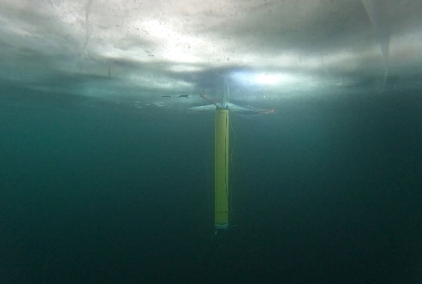
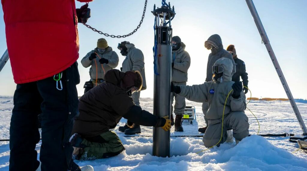
To overcome this challenge, NASA JPL scientists are developing a series of fully autonomous cylindrical robots. Each robot is approximately 8 feet long and 10 inches in diameter, equipped with three-legged landing gear that allows it to attach securely to the underside of the ice.
Once deployed through boreholes or from vessels, they will ride ocean currents to their targets, where they will attach themselves to the underside of the ice to collect crucial data over a year. This data will help scientists better predict sea level rise by accurately measuring ice melt rates in previously inaccessible regions.
Recent tests in the frigid waters of the Beaufort Sea, following earlier trials in California’s Monterey Bay and Lake Superior, have shown promising results. Although further development is needed, the IceNode project may help us not only navigate some of the coldest, darkest, and most unknown waters in the Arctic but also better understand the effects of climate change.
Kenna Hughes-Castleberry is the Science Communicator at JILA (a world-leading physics research institute) and a science writer at The Debrief. Follow and connect with her on X or contact her via email at kenna@thedebrief.org