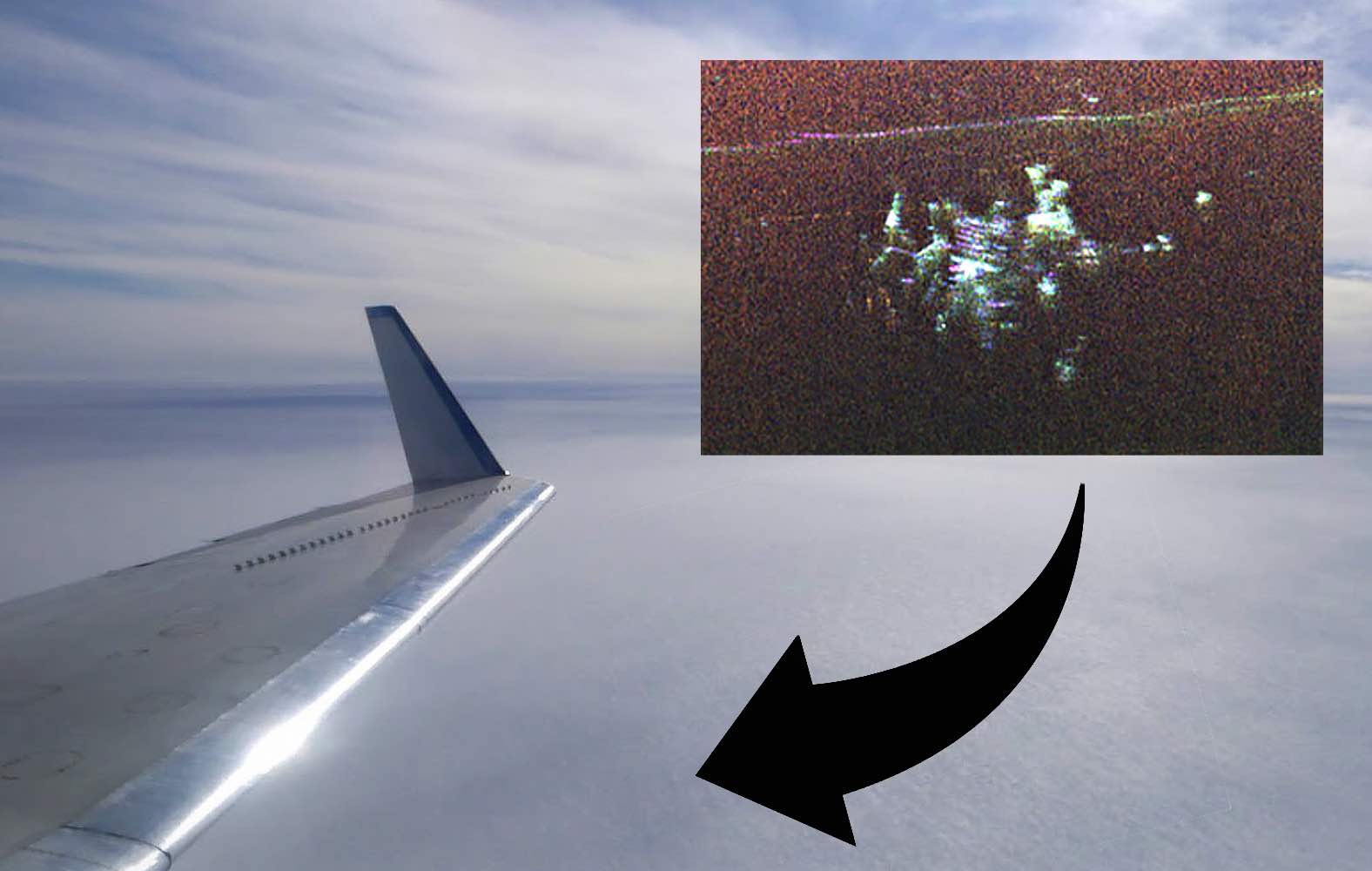
When it first appeared in their radar images, NASA scientist Chad Greene and his team of engineers weren’t sure what they were seeing.
Flying above northern Greenland in a Gulfstream III in April of this year, Greene and his crew were monitoring radar information collected from the ice sheet below when, about 150 miles east of Pituffik Space Base—formerly Thule Air Base and still the northernmost installation operated by the U.S. Armed Forces—they spotted something unexpected.
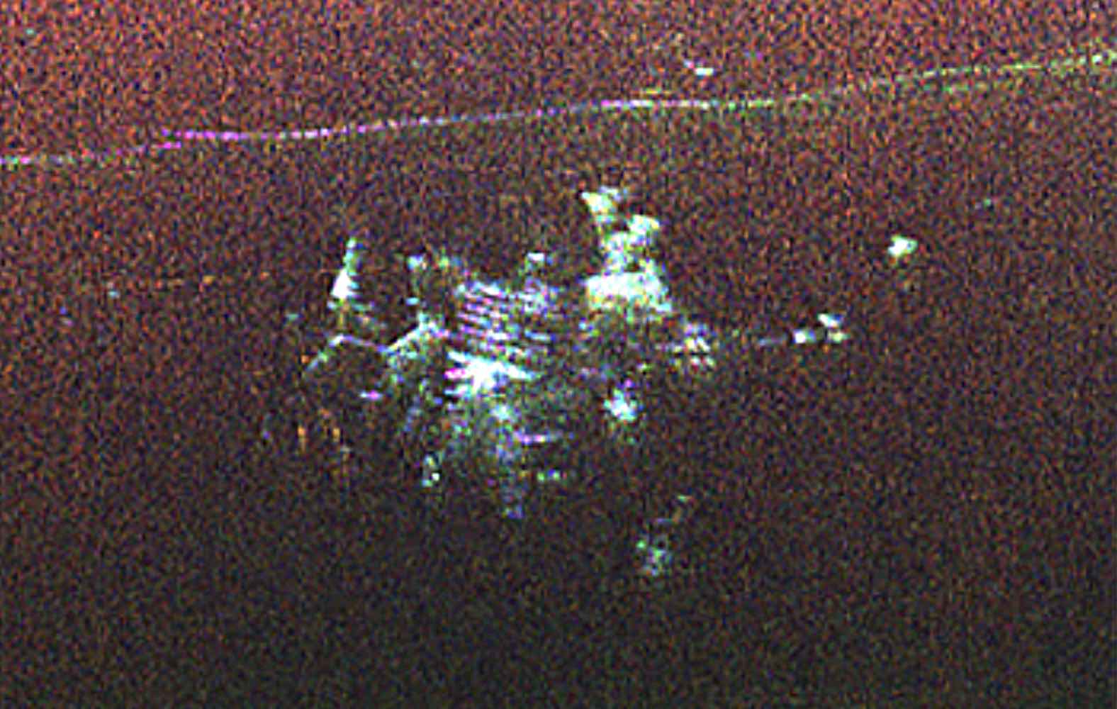
The aircraft’s radar system had detected some kind of structure buried beneath the ice.
“We didn’t know what it was at first,” recalled cryospheric scientist Alex Gardner with NASA’s Jet Propulsion Laboratory (JPL). In the radar imagery, what appeared to be a massive structure had been revealed deep beneath the frozen landscape.
“We were looking for the bed of the ice,” Gardner said, “and out pops Camp Century.”
A Cold War Relic Reemerges
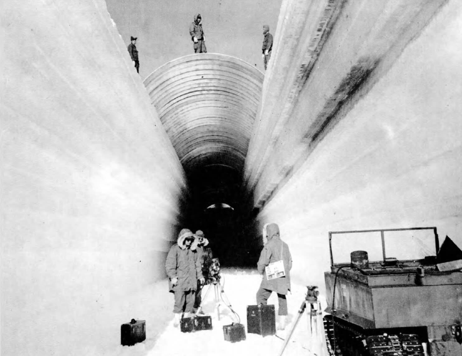
A remote U.S. military base once used as a top-secret testing site for the deployment of nuclear missiles from the Arctic, Camp Century was constructed by the U.S. Army Corps of Engineers within the Greenland Ice Sheet in 1959. Remaining in use for less than a decade, the base was decommissioned after just eight years and abandoned beneath Greenland’s frozen landscape.
Also known as the “city under the ice,” this forgotten Cold War relic consists of a network of tunnels hewn into the near-surface portions of the ice sheet. Today, the remnants of the secretive base lay hidden beneath close to 100 feet of snow and ice that have continued to accumulate since it was decommissioned.


Rediscovering a City Under the Ice
This wasn’t the first time the U.S. military’s forgotten Cold War stronghold in Greenland had been detected during airborne surveys. In the past, aircraft using ground-penetrating radar have also detected signs of the hidden underground facility, albeit resembling little more than a small disturbance within the surrounding deformed layers of ice.
Unlike those past surveys, in April when Greene, Gardner, and their NASA crew passed overhead, they were armed with the space agency’s Uninhabited Aerial Vehicle Synthetic Aperture Radar (UAVSAR), a radar system mounted directly to the underbelly of their aircraft that enables enhanced radar imaging capabilities.
“In the new data, individual structures in the secret city are visible in a way that they’ve never been seen before,” Greene said, noting that the cryospheric science team from JPL was successfully able to corroborate their radar images with historical maps depicting Camp Century’s sprawling tunnels and other structural features.
A Potential Concern Amid Melting Ice
Based on the data from the radar images, the ice bed the researchers had been studying appears to lay close to a mile below the surface of the ice, which is still far below Camp Henry, even at its current depth.
The remnants of Camp Henry’s Cold War activities pose no threat at the abandonned facility’s present depth. However, as melting continues to wear away the Greenland Ice Sheet, scientists are aware that it could someday be exposed once again, meaning that any radioactive waste and other potentially harmful chemical or biological waste that was left behind when the facility was decommissioned in 1967 could also resurface.


Although the radar imagery obtained in April by Greene and Gardner could prove useful in terms of ongoing monitoring of such threats as melting continues, the researchers said the images of this forgotten vestige of the Cold War they obtained occurred entirely by chance.
“Our goal was to calibrate, validate, and understand the capabilities and limitations of UAVSAR for mapping the ice sheet’s internal layers and the ice-bed interface,” Greene said.
“Without detailed knowledge of ice thickness, it is impossible to know how the ice sheets will respond to rapidly warming oceans and atmosphere, greatly limiting our ability to project rates of sea level rise,” Gardner added.
The radar imagery of Camp Century obtained by Greene and Gardner was showcased as the Image of the Day for November 25, 2024 at NASA’s Earth Observatory website, as reported by Kathryn Hansen with images by Michala Garrison and Jesse Allen.
Micah Hanks is the Editor-in-Chief and Co-Founder of The Debrief. He can be reached by email at micah@thedebrief.org. Follow his work at micahhanks.com and on X: @MicahHanks.

