Odd-looking ice formations once prominent on the frozen surface of Antarctica are vanishing, and now scientists are using half a century of satellite imagery to track changes occurring on the surface of the White Continent to explain why.
Within aerial imagery collected as far back as the early 1970s, mysterious humps arising from the continent’s icy surface were once prominent, particularly along coastal areas near ice shelves, where these massive floating ice formations are attached to the greater landmass.
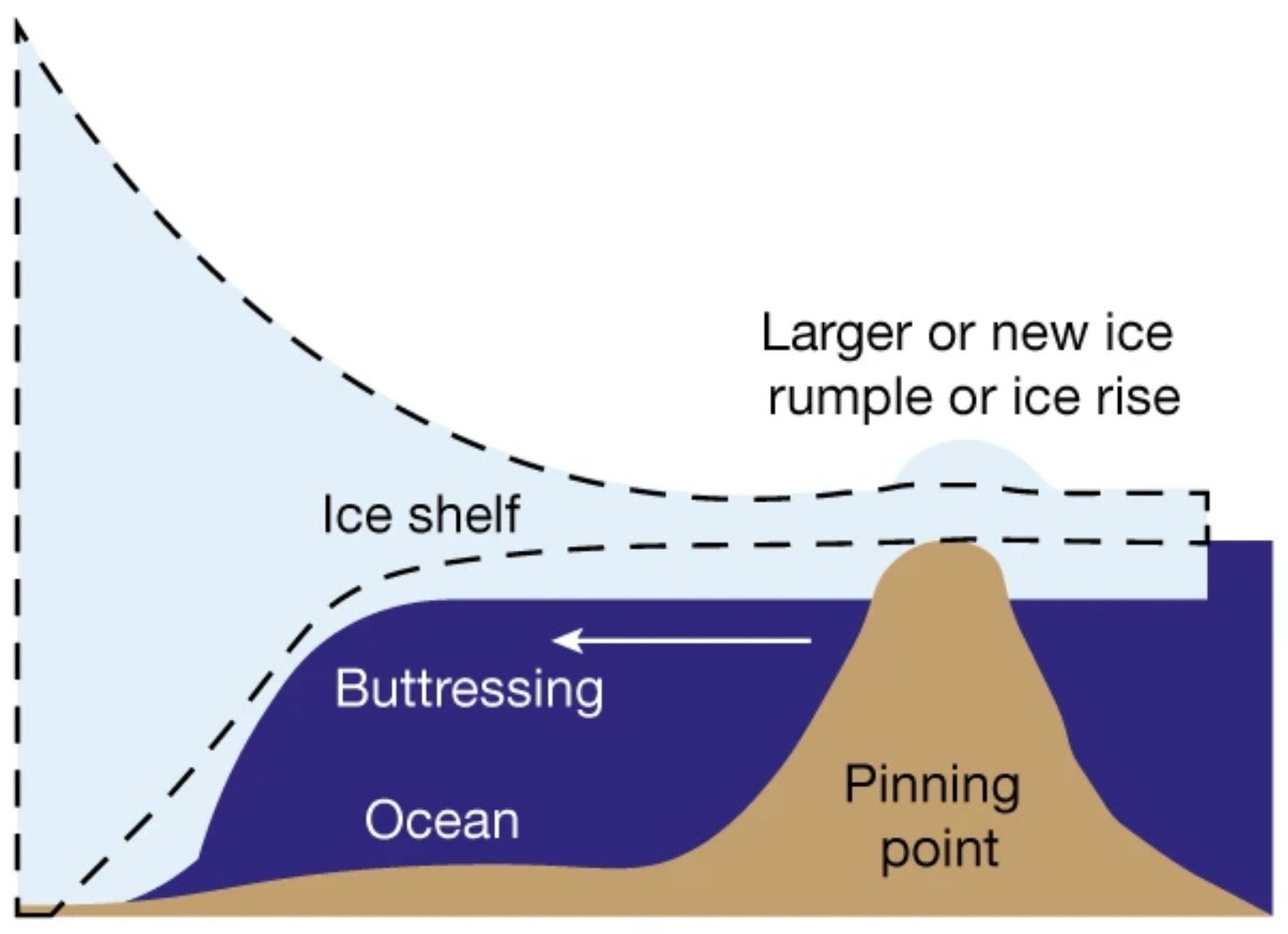
Scientists liken ice shelves to being glacier “tongues” that extend the land-based ice further outward from the coast and over the nearby ocean. Presently, most of the ice shelves on planet Earth are found along Antarctica’s coasts, where they help to restrain the flow of ice from further inland.
The role of these ice sheets is significant, since they assist in preventing ice on mainland Antarctica from making its way toward the coasts, where it can eventually enter the ocean and, upon melting, contribute to sea level rise.
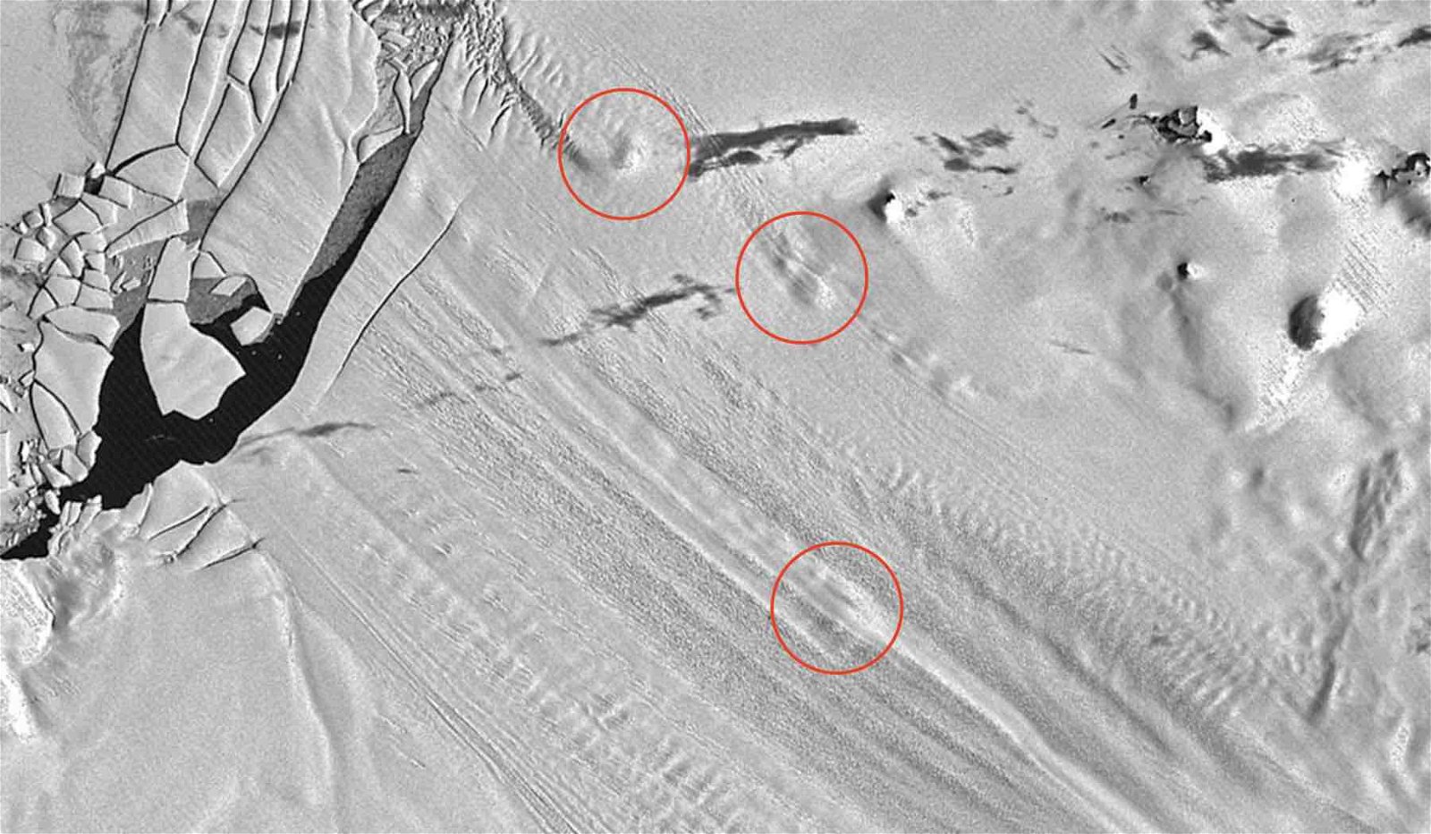
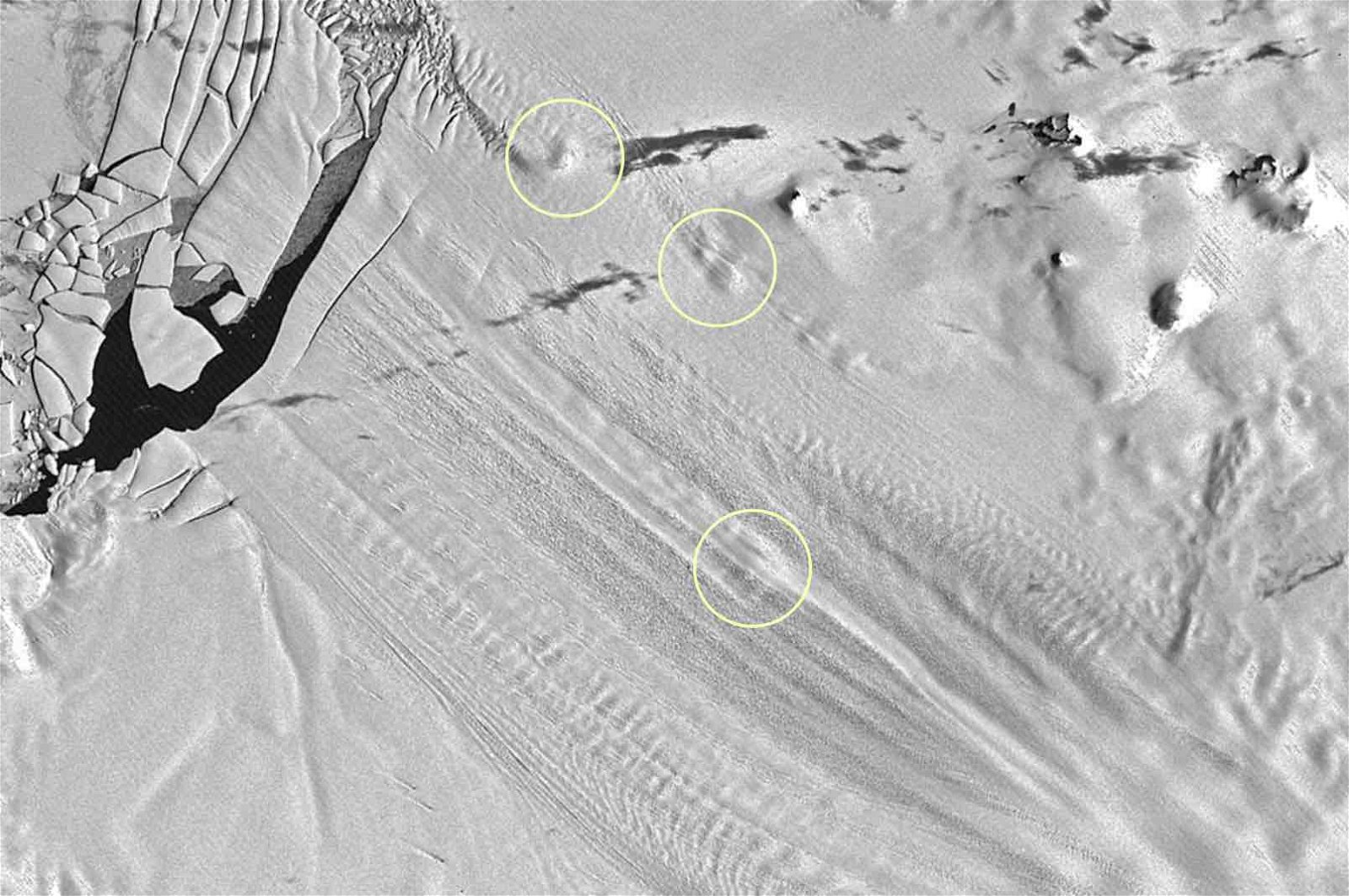
Antarctica’s mysterious humps were eventually identified as areas where “pinning points” existed, comprising locations where regions of the floating ice shelves have effectively dropped anchor and attached themselves to high points on the underlying sea floor.
Now, satellite imagery spanning several decades shows that many of these pinning points have completely vanished.
The disappearance of pinning points serves as a useful indicator that their related ice shelf may have become unpinned, as they are recognized as an effective source for gauging ice shelf thickness. When these rising humps gradually smooth out and vanish over time, it usually indicates that the ice shelf is gradually detaching from its anchor points on the sea floor.
Prior to the 1990s, optical imagery provided a useful method of capturing variations in the surface features of Antarctica before the arrival of satellite altimetry data available today. With post-1990s imagery obtained from orbit, a greater amount of thinning to the continent’s ice shelves was revealed, as well as the disappearance of several pinning points once prevalent in aerial photography.
Now, with the help of half a century of satellite imagery obtained from NASA’s Landsat satellites, a pair of researchers with the University of Edinburgh are peering back in time to gain a better understanding of the dynamics of the White Continent and its gradual loss of ice over time.
Researchers Bertie Miles and Robert Bingham have found evidence of thinning as early as the 1970s, although limited to smaller portions of the continent’s ice shelves along the eastern coastline of Antarctica.
Fast forward two decades to the 1990s, and the rapid spread of thinning becomes evident in satellite imagery.
“While many previous studies have reported ongoing ice shelf thinning around Antarctica since the 1990s, we didn’t previously know that a lot of it started around then,” Bingham said in a statement.
Bingham points to his colleague Mile’s use of Landsat imagery to map locations where the pinning points once existed as a useful tool in revealing “a proxy for ice shelf thickness change, alongside the more sophisticated altimetry methods the community has generally used.”
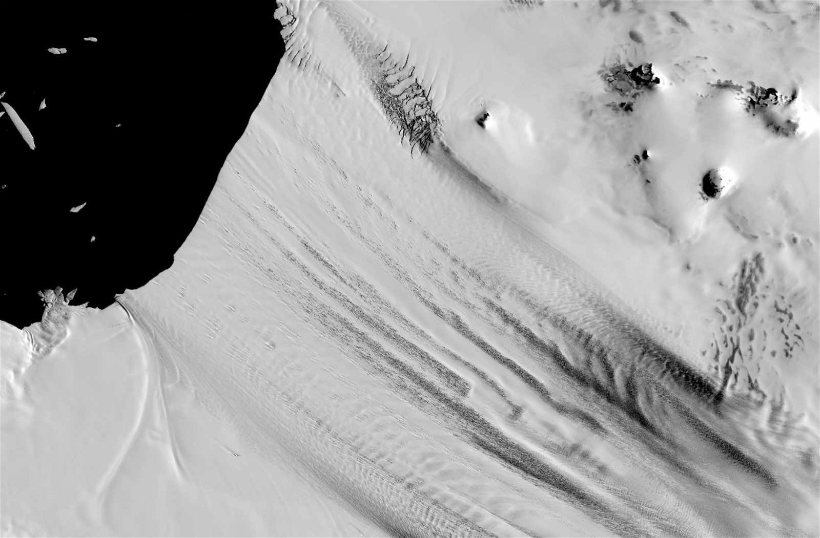
Images made available on NASA’s Earth Observatory page reveal the changes rather dramatically with a side-by-side comparison that provides a tool that allows users to drag back and forth to reveal the appearance of the ice sheet decades ago in 1973 alongside how it looked when photographed by Landsat 1’s Multispectral Scanner and Landsat 7’s Enhanced Thematic Mapper Plus instruments.

However, the pinning points that once served as anchor points for the overlying ice sheets aren’t all that have vanished. Toggling the tool provided in the NASA imagery all the way to the left reveals a significant amount of ice once visible in aerial imagery from the 1970s that was completely gone by 2001, leaving a gaping bay where portions of the ice sheet adjacent to Pine Island Glacier once existed.
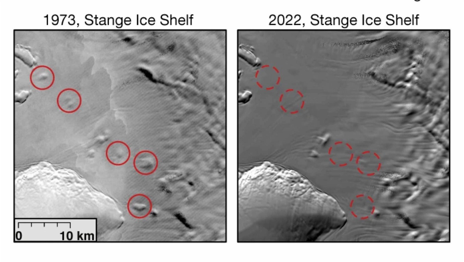
“These images show the pinning points getting smaller through time as warm ocean currents melt the ice shelves,” Miles told Earth Observatory, “causing them to thin and subsequently unanchor from the seafloor highs.”
Based on Bingham and Miles’ findings, the area around Pine Island Glacier had begun thinning at a much earlier time than most of the ice shelves elsewhere on the continent. Tracking close to 600 pinning points that were once visible, only 15 percent displayed evidence of shrinking from the earliest available imagery up until around 1989, even around the Amundsen Sea Embayment where Pine Island Glacier is located.
However, between 1990 and 2000, that percentage shot up to nearly 25 percent. In recent years, the percentage has now risen to almost 37 percent, covering a period of just two years falling between 2000 and 2022.
Miles and Bingham argue that similar to Pine Island Glacier, there could be other major ice shelves that may be nearing or already completely detached from their anchor points, which greatly reduces their capacity for buttressing ice from further in the mainland and combatting sea level rise.
Miles and Bingham’s study, “Progressive unanchoring of Antarctic ice shelves since 1973,” was published in the journal Nature on February 22, 2024.
Micah Hanks is the Editor-in-Chief and Co-Founder of The Debrief. He can be reached by email at micah@thedebrief.org. Follow his work at micahhanks.com and on X: @MicahHanks.