In the distant past, Mars was once a much warmer and wetter planet than its barren red landscape would indicate today. Now, NASA’s Curiosity Rover has begun investigations of an area that could offer significant insights into the disappearance of liquid water on Mars, when that occurred, and whether it could have been host to life on the Red Planet.
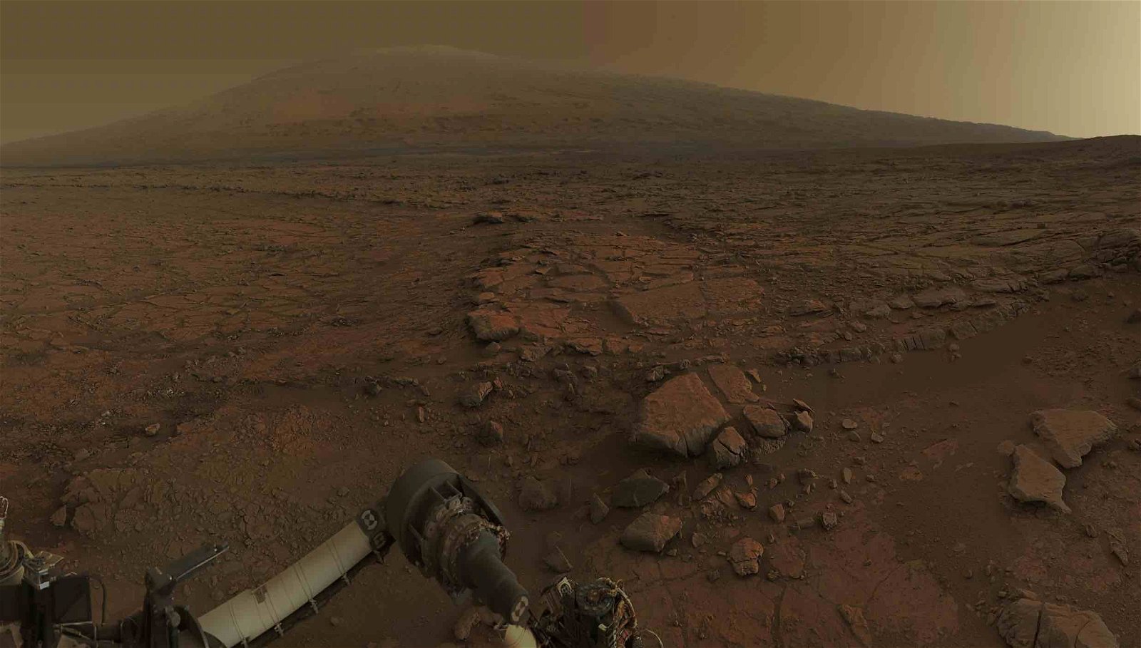
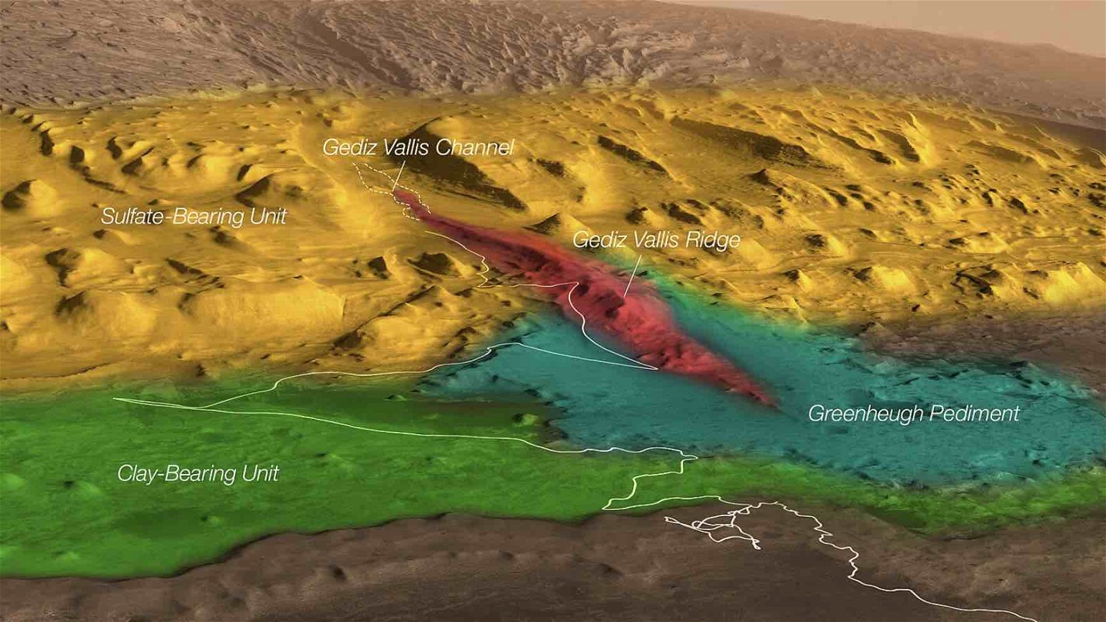
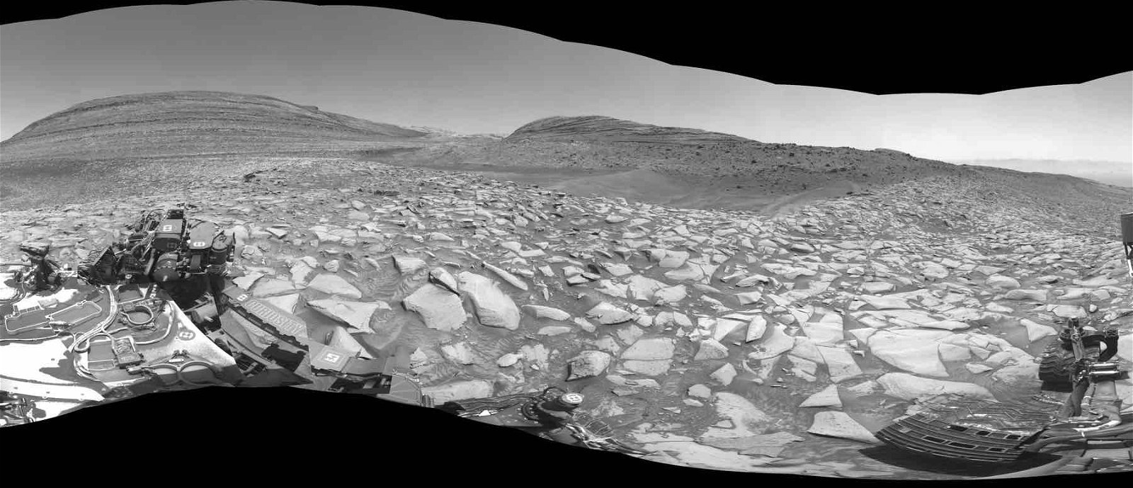
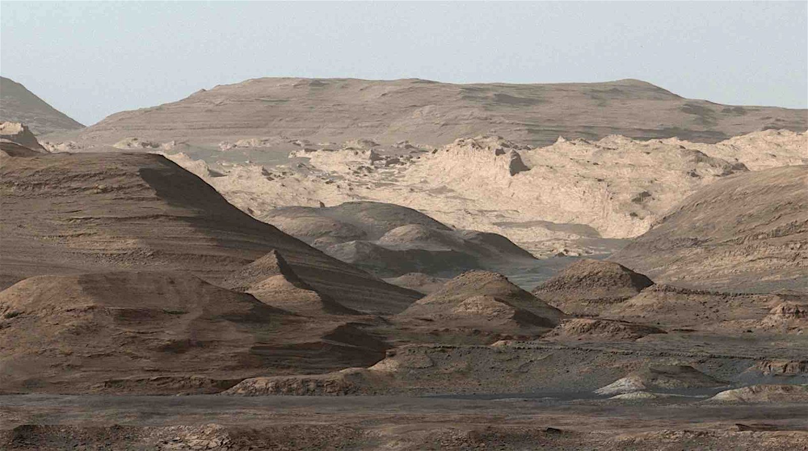
The rover’s investigations have recently brought it to the Gediz Vallis channel, an area that billions of years ago would have looked far more like Earth. Based on the data Curiosity obtains during its explorations, scientists hope to understand how the Gediz Vallis channel formed and whether the ancient channel was indeed the result of the windings of an ancient river that once coursed along the Martian surface.
A Decade of Exploration
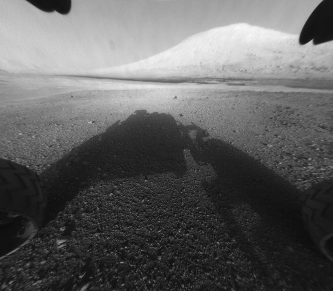
NASA’s Curiosity rover touched down at the Bradbury Landing site in “Yellowknife” Quad of Aeolis Palus in early August 2012. The following June, it was announced that the rover would begin its roughly five-mile (8 km) trek to the base of Aeolis Mons, otherwise known as Mount Sharp, which forms the central peak of Gale Crater.
Curiosity has spent the last decade making its way up the mountain, traversing the peak’s layered lower foothills and allowing scientists to observe an area that showcases the changes of the Martian landscape over time.
One of Curiosity’s primary objectives is to determine whether water and the chemicals required for life to exist would have been present in the area. The existence of clay minerals already shows that water would have once interacted with the rock on the Martian surface. Current investigations by Curiosity are now looking at the presence of sulfates in the area, which is believed to have formed long ago as the last water in the region finally evaporated.
Signs of Water Flowing on Ancient Mars?
NASA’s Jet Propulsion Laboratory recently said that Curiosity is probing the landscape for signs that the mysterious Gediz Vallis channel might have been slowly carved into the Martian bedrock by the flow of water billions of years ago. Although it was considered that the channel could have been formed by winds that are still prevalent on Mars, the steepness of the channel’s sides is more consistent with the movement of liquid water, either resulting from a sudden flow that carried debris from a landslide, or possibly the constant flow of water from a river.
Today, the channel is packed with stony debris, which the Curiosity team believes could have been relocated into the channel because of dry avalanches, although the possibility that these rocky areas at the base of the formation might have been carried with the help of water long ago is a tantalizing possibility.
“If the channel or the debris pile were formed by liquid water, that’s really interesting,” said Ashwin Vasavada, Curiosity’s project scientist with NASA’s JPL. “It would mean that fairly late in the story of Mount Sharp – after a long dry period – water came back, and in a big way.”
Vasavada and the Curiosity team believe that if this were the case, it would match previous findings that indicated water seems to have vanished and reappeared over several phases as the planet gradually became more arid.
Unraveling Mount Sharp’s Mysteries
The Curiosity team says the rover will take several months to explore the channel, which could help lead to new insights—and possibly revisions—to our understanding of the timeline for Mount Sharp’s formation.
Although the feature’s sedimentary layers were deposited by wind and water, they didn’t initially look like they do today; erosion over long periods gradually revealed the layers that are present today, processes that would have also been required for the formation of the Gediz Vallis channel.
In addition to searching for evidence of water that may have carved the channel, most of the stony debris that now fills its base probably originates from further up Mount Sharp’s slopes, which allows Curiosity a chance to observe the mineral composition of stone from a region that it will never actually visit during its mission.

NASA has made additional information about Curiosity’s investigations available on its Mars Exploration page, which includes its science goals and frequent mission updates on its ongoing exploration of the Red Planet.
Micah Hanks is the Editor-in-Chief and Co-Founder of The Debrief. He can be reached by email at micah@thedebrief.org. Follow his work at micahhanks.com and on X: @MicahHanks.