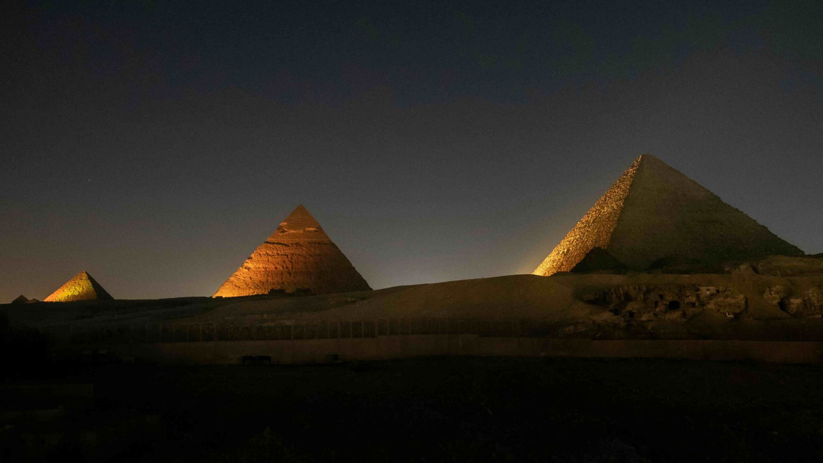
Egypt’s Pyramids have long fascinated archaeologists and the general public. Giant and mysterious, these looming structures beckon us to wonder and speculate about our shared human history. Now, new research published in Communications Earth & Environment is shedding light as to how the pyramids were built, but also why they rest in the middle of a barren desert.
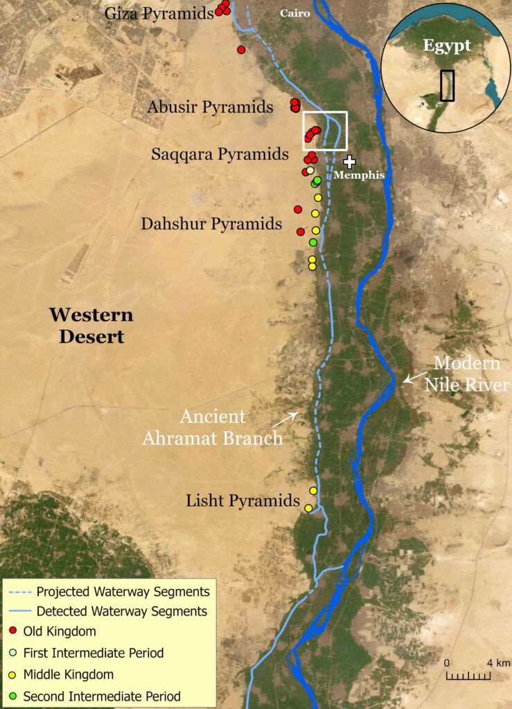
Led by University of North Carolina, Wilmington’s Dr. Eman Ghoneim, she and her team identified a long-lost Nile river branch, named the Ahramat Branch, which seems to have played a crucial role in the construction of Egypt’s largest pyramid field.
This finding not only provides a plausible explanation for the pyramids’ strategic location but also offers insights into the logistical challenges faced by the ancient builders.
The study focuses on the northern Nile Valley, specifically the area between Lisht in the south and the Giza Plateau in the north. This region hosts the largest concentration of pyramids, yet until now, no convincing explanation has been provided for why these monumental structures are clustered along a narrow desert strip.
“Monumental structures, such as pyramids and temples, would logically be built near major waterways to facilitate the transportation of their construction materials and workers,” Ghoneim and her team wrote in their paper. “Yet, no waterway has been found near the largest pyramid field in Egypt, with the Nile River lying several kilometers away.”
The research team used a combination of radar satellite imagery, geophysical data, and deep soil coring to investigate the subsurface structure and sedimentology of the Nile Valley adjacent to these pyramids.
Their findings reveal segments of a major extinct Nile branch, the Ahramat Branch, running at the foothills of the Western Desert Plateau. This branch, which was active during the Old and Middle Kingdoms, the periods in Egypt’s history where pyramid building was prevalent, provided a vital waterway for transporting construction materials and workers to the pyramid sites. The study suggests that many of the pyramids have causeways leading to this branch, terminating in Valley Temples that may have functioned as river harbors.
“It has been speculated by many scholars that the ancient Egyptians used the Nile River for help transporting construction materials to pyramid building sites, but until now, this ancient Nile branch was not fully uncovered or mapped,” the study states.
“This work can help us better understand the former hydrological setting of this region, which would, in turn, help us learn more about the environmental parameters that may have influenced the decision to build these pyramids in their current locations during the time of Pharaonic Egypt.”
The researchers employed a multi-faceted approach to uncover the Ahramat Branch. Synthetic Aperture Radar imagery and radar high-resolution elevation data were used to detect subtle topographic expressions of the ancient river. These remote sensing techniques allowed the team to trace the course of the Ahramat Branch, which lies between 2.5 and 10.25 kilometers west of the modern Nile River. The branch has a channel depth of 2-8 meters, a length of about 64 kilometers, and a width of 200-700 meters, comparable to the contemporary Nile.
Geophysical surveys, including Ground Penetrating Radar and Electromagnetic Tomography, were conducted along a 1.2-kilometer profile. These surveys revealed a hidden river channel lying 1-1.5 meters below the cultivated Nile floodplain. The geophysical data showed a distinct unconformity, indicating sediments with different textures than the overlying floodplain silt deposits. This evidence was further validated by sediment cores, which confirmed the presence of an ancient riverbed.
Rivers evolve over time, and a little over 11,700 years ago, during the Early Holocene, the Sahara transformed from a hyper-arid desert to a savannah-like environment with large river systems and lake basins. This period saw high Nile River discharge and the presence of several secondary channels branching across the floodplain.
As the climate became more arid in the Late Holocene, the Nile’s discharge decreased, and its floodplain rose in height due to increased sedimentation. This led to the migration of people towards the Nile Valley, which occurred around 6,000 BCE, and the construction of early pyramid complexes along the desert margins. The Ahramat Branch, active during this time, provided a crucial waterway for the transportation of materials and workers, facilitating the construction of the pyramids.
“This waterway would have connected important locations in ancient Egypt, including cities and towns, and therefore, played an important role in the cultural landscape of the region,” the team explains.

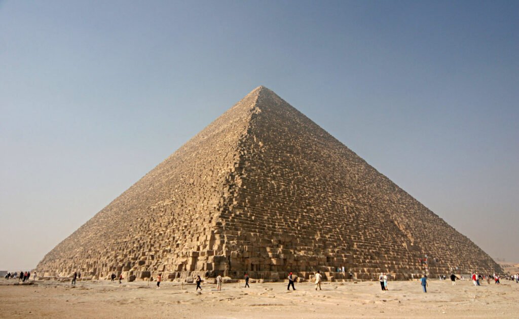
The discovery of the Ahramat Branch offers a comprehensive explanation for the logistical feasibility of building the pyramids. Transporting massive limestone and granite blocks, some weighing several tons overland, would have been extremely difficult. The waterway would have provided a natural and efficient route for moving these heavy materials from quarries to the construction sites. This waterway would have also facilitated the movement of workers, ensuring a steady supply of labor.
The pyramids’ proximity to the Ahramat Branch explains why they are concentrated along a narrow desert strip. The availability of a nearby waterway minimized the distance materials and workers needed to be transported, reducing logistical challenges and costs. The study’s evidence of causeways terminating at the river supports the hypothesis that the ancient Egyptians used the Ahramat Branch as a harbor for unloading materials directly at the construction sites.
Moreover, the branch most likely served as a sort of roadway for visitors and for ceremonies.
“In Egyptian pyramid complexes, the valley temples at the end of causeways acted as river harbors. These harbors served as an entry point for the river-borne visitors and ceremonial roads to the pyramid,” the team wrote. “Countless valley temples in Egypt have not yet been found and, therefore, might still be buried beneath the agricultural fields and desert sands along the riverbank of the Ahramat Branch.”
Overall, the team argues that the pyramids were built along this branch, which, like the Nile, followed a fairly regular flooding schedule. Using these patterns, the ancient Egyptians would utilize this water way to access these massive structures. The findings of this study have broader implications for our understanding of ancient Egyptian civilization. The Nile River has always been a lifeline for Egypt, providing sustenance and functioning as the main water corridor for transportation. The discovery of the Ahramat Branch highlights the ingenuity of the ancient Egyptians in utilizing natural resources to overcome the logistical challenges generated by their desire and, let’s be honest, ego to build incredibly massive structures.
By mapping the paleohydrological setting of the Lisht-Giza area, Ghoneim, and her team have perhaps uncovered the mystery that influenced the decision to build the pyramids in their current locations. This research sheds light not only on the construction techniques but also on the broader development of a remarkable ancient civilization.
MJ Banias covers space, security, and technology with The Debrief. You can email him at mj@thedebrief.org or follow him on Twitter @mjbanias.